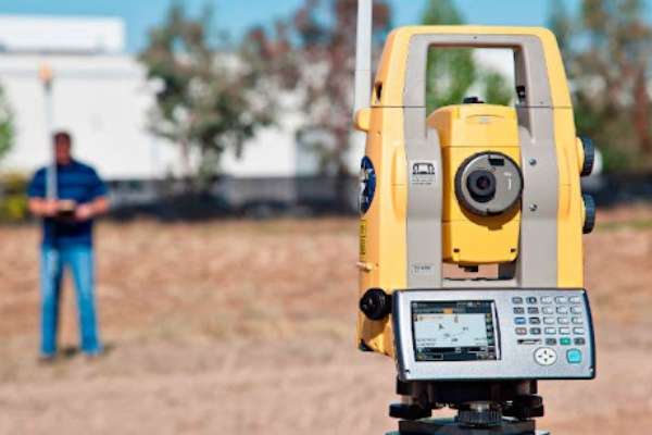
Our company provides comprehensive GIS (Geographic Information Systems) and DGPS (Differential Global Positioning System) survey services, designed to meet the diverse needs of clients across various industries. Utilizing the latest technology and methodologies, we deliver accurate and reliable geospatial data critical for informed decision-making and effective project execution.

Our GIS surveying services provide an effective method for gathering, analyzing, and visualizing geographic data. We convert intricate spatial data into practical insights, catering to various applications including urban planning and environmental management.
Key Services
Data Collection & Integration: We gather geospatial data from diverse sources, including satellite imagery, aerial photography, and field surveys. Our team ensures seamless integration with existing datasets, establishing a comprehensive geographic database.
Spatial Analysis: Leveraging advanced GIS software, we conduct thorough spatial analysis to discern patterns, relationships, and trends within the data. This analysis aids in understanding geographical contexts and facilitates strategic planning.
Mapping & Visualization: We craft detailed maps and visual representations of geographic data, simplifying the interpretation and communication of complex information. Our bespoke maps are tailored to address specific client requirements.
Geodatabase Management: We offer robust geodatabase management services, ensuring the integrity, security, and accessibility of data. Our solutions facilitate efficient data storage, retrieval, and sharing.
Consulting & Training: Our team of experts provides consulting services to assist clients in optimizing the benefits of GIS technology. Additionally, we offer training programs designed to equip teams with the necessary skills to effectively utilize GIS tools.

DGPS Survey Services
Our DGPS Survey Services provide highly accurate positioning data, essential for projects requiring precise geolocation information. DGPS enhances the accuracy of GPS measurements, making it ideal for applications that demand high levels of precision.
Key Services
High Accuracy Positioning: Utilizing advanced DGPS technology, we achieve sub-meter accuracy, ensuring precise location data for all types of surveys.
Field Surveys: Our experienced surveyors conduct on-site data collection using state-of-the-art DGPS equipment. We cover a wide range of surveys, including topographic, boundary, and construction staking.
Real-Time Data Processing: We provide real-time data processing and correction, ensuring that the information collected is accurate and reliable. This is critical for time-sensitive projects.
Data Integration: Our DGPS data seamlessly integrates with GIS platforms, enhancing the overall geospatial analysis and mapping capabilities. This integration supports comprehensive project planning and management.
Customized Solutions: We tailor our DGPS services to meet the specific needs of each client. Whether it’s a large-scale infrastructure project or a small-scale land development, we deliver solutions that align with project goals
Why Choose Us
- Expertise and Experience: Our team of skilled professionals has extensive experience in conducting GIS and DGPS surveys across various sectors.
- Advanced Technology: We use the latest GIS and DGPS technology to ensure the highest levels of accuracy and reliability.
- Customized Solutions: We tailor our services to meet the specific needs and goals of each client, ensuring optimal results.
- Comprehensive Reporting: Receive detailed reports and visualizations that provide clear insights into your spatial data.
- Commitment to Quality: We adhere to industry standards and best practices to deliver high-quality, dependable survey services.


